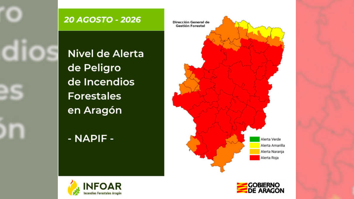
A total of 17 areas of Aragon present a red alert on Monday due to a very high risk of forest fires. The other 9 areas into which Aragon is divided in these risk maps today have an orange alert, according to the index prepared by the Directorate General of Forest Management of the Government of Aragon.
The areas with red alert are Bajo Ebro Forestal, Depression del Jalón, Gúdar, Javalambre, Jiloca-Gallocanta, Maestrazgo, Mijares, Moncayo and Aranda, Montes Universales, Muela de Alcubierre, Muela de Valmadrid, Eastern Pre-Pyrenees, Rodeno, Central Iberian Sierras, Eastern Somontano, South Somontano and Turia.
The Forest Fire Danger Alert Level (NAPIF) indicates the daily situation of danger from forest fires in Aragon, with a risk classification classified into four levels: low, medium, high and very high, represented by the colours green, yellow, orange and red. Within the red level, the Red Plus situation (red +) is included for those exceptional episodes that may present an extreme danger.
Today’s NAPIF describes that there is a very high or total availability of dead fuel throughout Aragon. As for the spread, high-intensity fires are possible throughout the territory.
Light wind of variable direction is expected in the early and late hours, tending during the central hours to a westerly component in western Iberia, and to southern and eastern components in the rest, with occasional increases in intensity in western Iberian and Bajo Ebro during the afternoon.
There is a probability of very strong gusts associated with storms that, in the event of a nearby fire, could substantially modify its evolution. Possibility of storms mainly in the Pyrenees and areas in the east of the Community, which may spread in a weaker and more dispersed form to the rest of the territory.